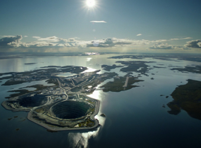


INSURANCE SATELLITE REMOTE SENSING
Price : 1-12 USD/km²
Combining satellite and remote sensing technologies with rights confirmation data and land parcel segmentation technology can vectorize and spatialize the subject matter of insurance, then establish a spatial database of the subject matter of insurance to provide spatial data and analysis management support for insurance underwriting and claim settlement.
SATELLITE REMOTE SENSING FOR AERIAL IMAGERY ANALYSIS INSURANCE FEATURES
1
Accurate Risk Assessment: Satellite aerial imagery analysis insurance can provide detailed information on properties, such as their size, shape, location, and condition. This can help insurers to accurately assess the risks associated with a property and determine appropriate coverage and premiums.
2
Data breach coverage: Satellite aerial imagery analysis insurance often involves handling sensitive data, which can be vulnerable to cyber attacks. This aerial imagery insurance can provide coverage for data breaches and associated costs, such as legal fees, notification expenses, and credit monitoring services.
3
Data Analytics and Predictive Modelling: Satellites used for remote sensing in insurance can provide insurers with a wealth of data that can be used to develop predictive models and identify patterns and trends. This can help insurers to better understand risks and make more informed decisions about coverage, premiums, and underwriting.
4
Improved Underwriting: Satellite aerial imagery analysis insurance can help insurers to identify and evaluate risks that may not be visible through traditional methods, such as physical inspections or surveys. This can lead to more accurate underwriting and better risk selection.
5
Enhanced Customer Experience: By leveraging satellite aerial imagery analysis, insurers can provide their customers with more personalized and customized insurance solutions, based on the specific risks associated with their properties. This can lead to increased customer satisfaction and retention.
changguang Jilin satellite constellation is the core project under construction by CGSTL. The first phase of the project consists of 138 high-performance optical remote sensing satellites covering video, high resolution, wide band, infrared, multispectral and other series.
Contact : global jl1, 0431 81785188
Good deal: buying from seller
We invite you to read our terms of use. You can also visit our FAQ section and see our information section on the risks associated with counterfeiting.
|
This page is about importers and exporters of INSURANCE SATELLITE REMOTE SENSING Search in a category : B2B Services Search in a category : sensing, satellite, remote, insurance |
Report abuse
Saturday, July 11, 2015
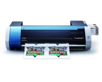
Quantity : 1 - Price : $3,429.00
Truly affordable. Remarkably versatile. With the VersaStudio, we've taken everything that makes a Roland printer great and packed it into one powerful, profit-producing package. Award-winning mild solvent inks. Your choice of media. One device that can print and cut an incredible...
Asia Toner Inc
- 12950 - Jakarta
- 6281361223405
Report abuse
Tuesday, July 07, 2026
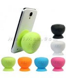
Quantity : 10000 - Price : 5€
Silicone Sucker Waterproof Bluetooth Speaker Material: Silicone gel USB Cable Length: about 76cm Item Dimension: about 62 x 62 x 61 mm Package Dimension: about 211 x 175 x 51 mm Parameters: 1. Buttons/Interfaces: ON/OFF Button, Micro USB Interface, play/pause, Next and Previous...
MaciMax intelligent téléphone accessoires grossiste
- hjb810410
- 13004 - Marseille
- 04 91 92 53 77
Report abuse
Tuesday, July 07, 2026
Our products are cut from a fossilized marble dating back to the Paleozoic era (450 million years). Our craftsmen have taken great care and ancestral know-how when extracted, its size and its polishing highlighting ammonites and Orthoceras that compose it. A mission all the more important...
la pierre d'erfoud sarl
- pierrederfoud
- 52200 - erfoud
- +212661997865